
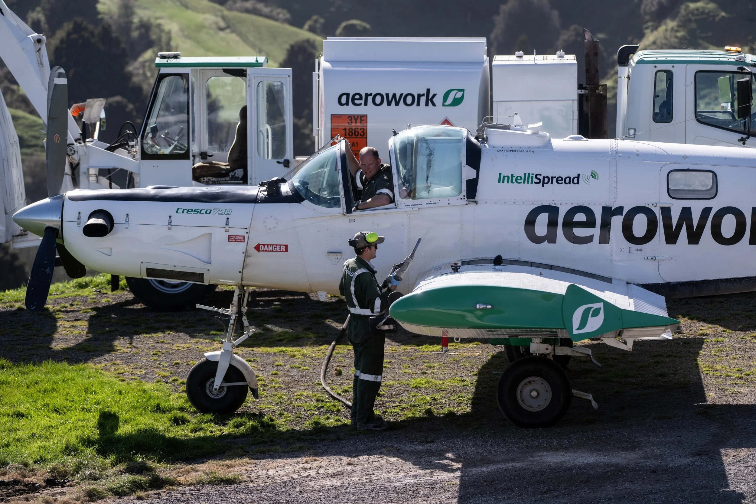
Across rural New Zealand, Aerowork delivers reliable, accurate aerial fertiliser spreading backed by skilled pilots, smart planning, and safe on-farm operations. We’ve helped farmers make the most of every weather window — putting product exactly where it needs to go, when it counts.
At Aerowork, precision isn’t a buzzword — it’s how we fly. Our pilots, aircraft, and technology work together to deliver fertiliser exactly where it’s needed, when it’s needed. From real-time GPS guidance to detailed proof-of-release* data, we help farmers make smarter decisions that lift productivity while reducing waste.
With decades of experience across New Zealand’s most challenging landscapes, we understand that every farm is different. Precision agriculture lets us tailor every load to your land, ensuring consistent application, better nutrient use, and more value from every tonne.
Aerowork’s approach is simple: fly smarter, apply smarter, and support farmers with tools that strengthen their business for the long haul.
*Don’t be fooled by claims of proof of placement being provided after each job. That needs capturing equipment on the ground to verify the spreading accuracy. Aerowork has tested and validated the accuracy of their proprietary Intellispread variable rate system with dedicated ground collection tests.
Learn more about New Zealand research into variable rate bulk fertiliser application using computer-controlled delivery from aircraft.
Precision agriculture
Farm mapping
Mapping the farm is the first and most important step in delivering safe, accurate aerial fertiliser application. At Aerowork, every customer farm is mapped by skilled staff who understand both the technology and the practical demands of rural New Zealand. Good mapping ensures fertiliser is applied only where it’s needed, protects waterways and native plantings, and sets the foundation for consistent, reliable spreading.
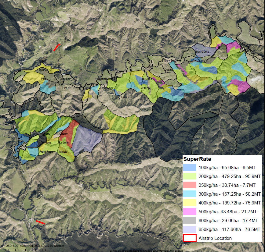
A complete map should show exactly where product should and shouldn’t go. This includes all paddocks scheduled for fertiliser, along with areas that must be excluded such as waterways, wetlands, bush blocks, buildings, and yards. Hazards like power lines, steep gullies, and towers are also identified to support safe flying and clean application.
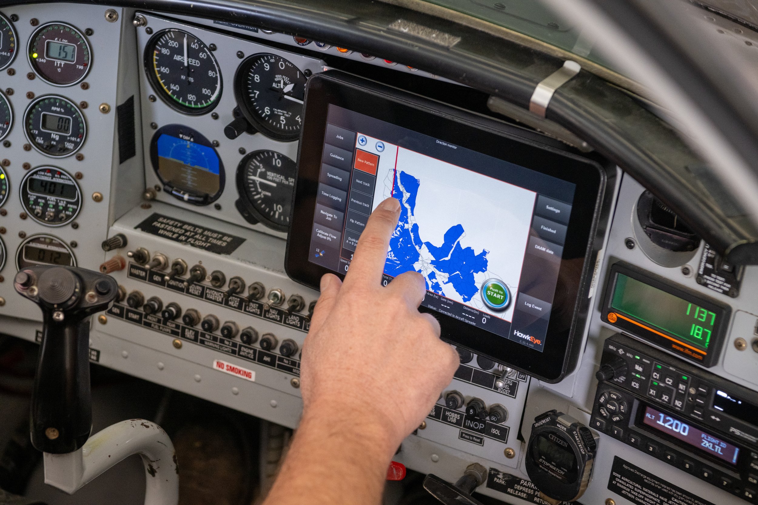
Accurate mapping enables the use of variable-rate technology, allowing different nutrient rates to be applied across different land classes or zones. It also helps define clear flight paths and ensures the aircraft’s automatic rate-control system opens and closes at precisely the right points.
Once the farm is mapped, the information is loaded into digital tools such as HawkEye, where application plans are created and sent directly to the aircraft. During the job, GPS guidance and rate-control technology use this map to deliver fertiliser accurately. Once spreading is complete, proof-of-release data is returned through HawkEye for compliance and farm planning. A well-prepared map not only saves costs and supports better pasture performance but also strengthens environmental stewardship by keeping nutrients away from sensitive areas.
In short, good mapping makes good spreading possible.
Proof of release
Proof of release has become a vital part of modern fertiliser application, giving farmers clear, verifiable records of where product has been applied and at what rate.
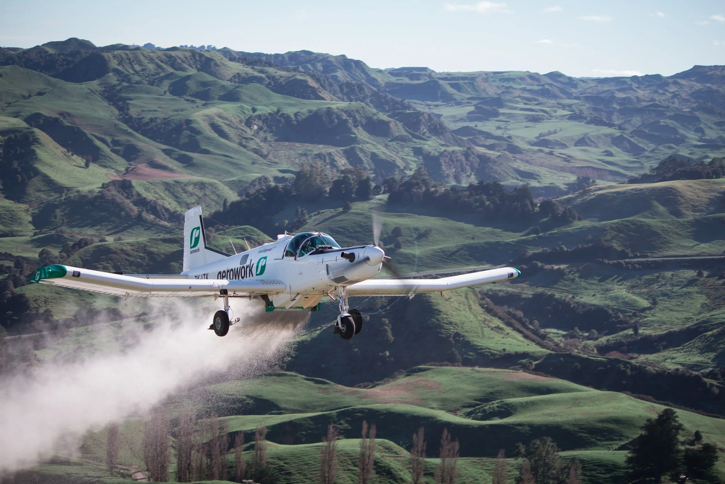
When an Aerowork aircraft completes a job, the GPS-guided system logs every flightline and records exactly when the hopper opens and closes. This data is returned through HawkEye as a proof-of-release map, creating a transparent digital record that supports nutrient budgets, compliance reporting, and farm assurance programmes such as NZFAP and environmental audits.
For farmers, it offers confidence that spreading has been done accurately and responsibly, and it provides independent documentation that aligns with industry standards and regulatory expectations. In a farming environment where traceability and good nutrient management are increasingly essential, proof of release is not just a nice-to-have — it’s part of doing things right.

Local pilots.
Local knowledge.
Local service.
Call today on 0800 237 696 or click here to book your job.